 |
||||||||||||||||
 |
||||||||||||||||
 |
||||||||||||||||
|
||||||||||||||||
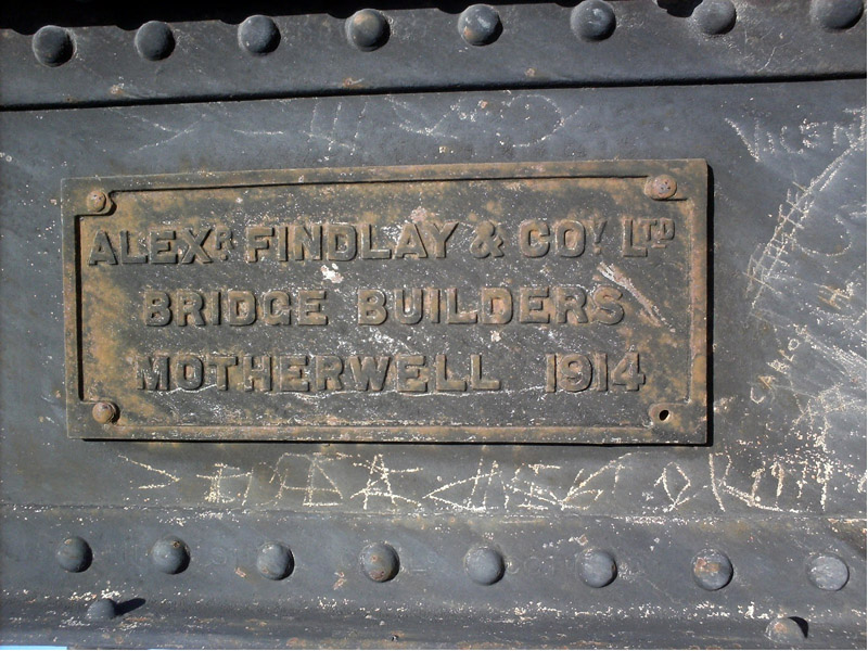
Joining up with the FC Sud The 'Southern' arrives in Carmen de Patagones On the line from Bahía Blanca to Patagones there was only one significant bridge – the one which took the line over the Río Colorado. The first part of this line was built and operated by the FC Buenos Aires al Pacífico. As was quite common, a temporary wooden bridge was built at the earliest opportunity to allow trains carrying construction materials to advance to the railhead. This bridge remained in use when the public service was started. A contract was placed with the firm of Alexander Findlay of Motherwell to design and fabricate the necessary truss bridge to allow the river to be crossed in a single span. The fabrication was carried out in 1914 and the components delivered to the site.
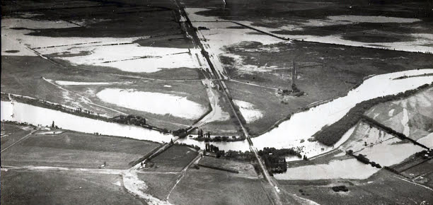
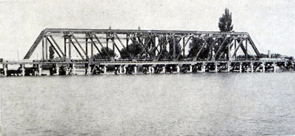
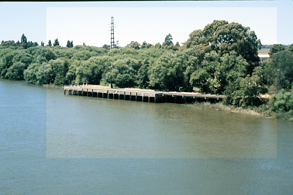
The Río Colorado was prone to, as is seen in this areal view, flooding from routine causes, unlike the disastrous flood of 1915, related elsewhere, and in December 1922, the traffic on the line was interrupted for ten days which prompted action on getting the bridge built.
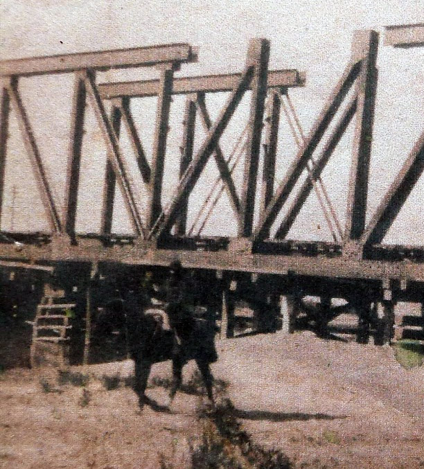
Assembly was not until 1924 when this view was taken of the permanent bridge under construction with bits of the parallel temporary wooden bridge being just visible under the bottom chord.
This view taken from the FC Sud's house magazine shows the virtually complete new bridge with the temporary wooden bridge in front of it.
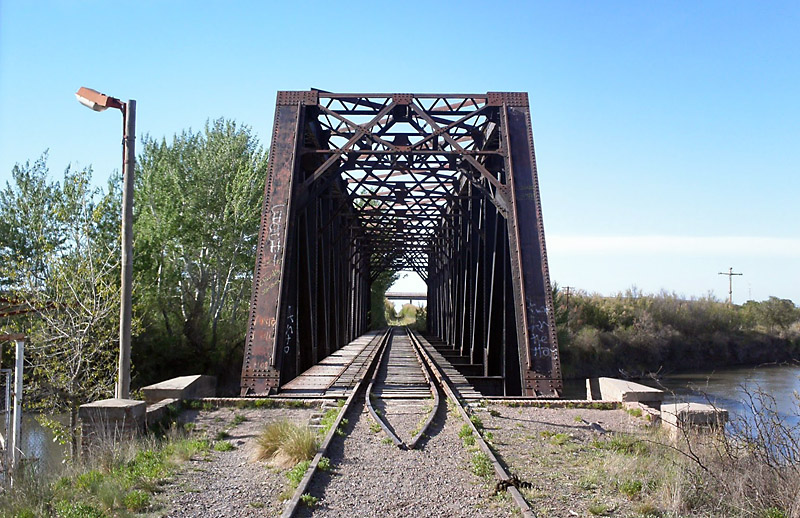
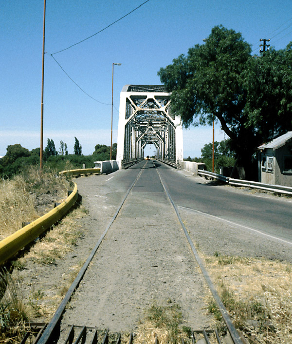
A modern view looking through the bridge. Unusually there would appear to be a planked walking route on the left next to the track.
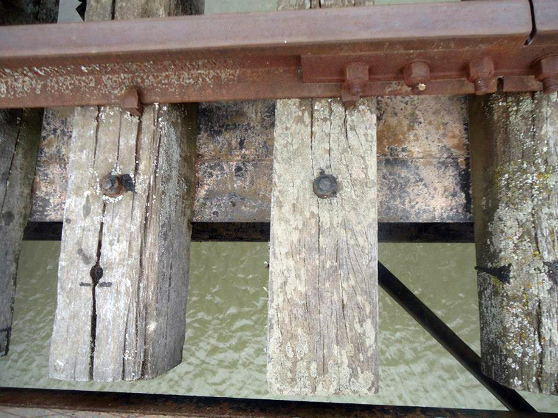
Each sleeper is bolted down to the flange of the supporting girder. There does not appear to be any packing provided so the sleepers must have been carefully selected to ensure a constant thickness.
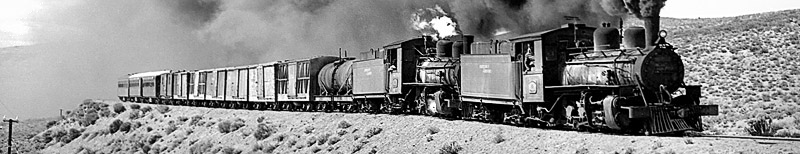
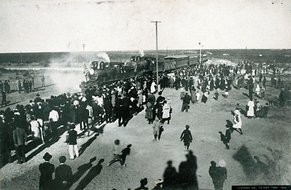
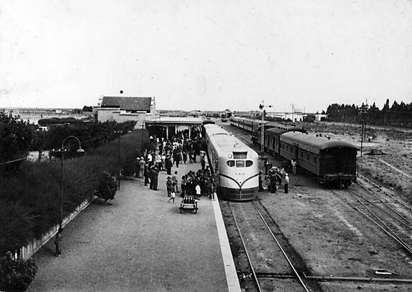
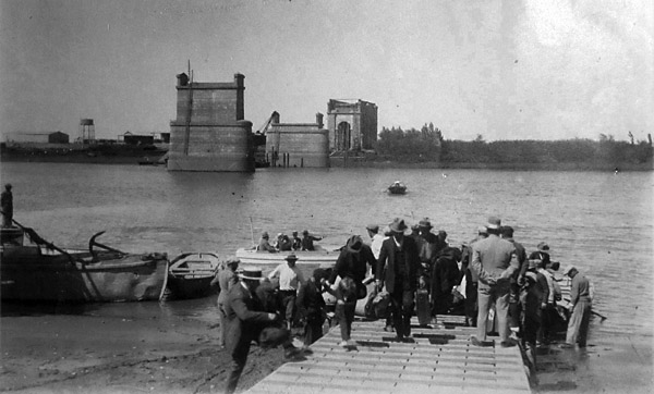
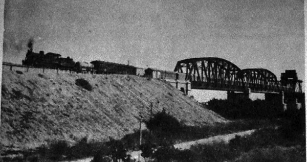
The photo shows the first train arriving in Patagones, double-headed and met by a large crowd. The FC Sud was British-owned, hence the Union Flag on the front engine.
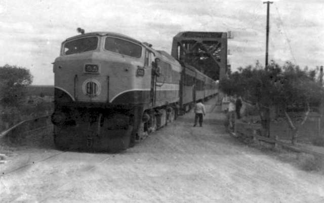
A 'tren Bariloche' set of Ganz railcars halts at Viedma station on its journey between Buenos Aires and San Carlos de Bariloche.
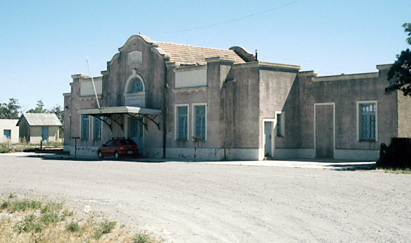
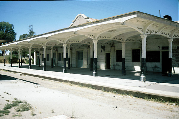
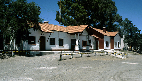
Carmen de Patagones station, in rather a depressing state these days and currently served by no passenger services at all though there are periodic attempts to restart through trains to Bariloche from further north.
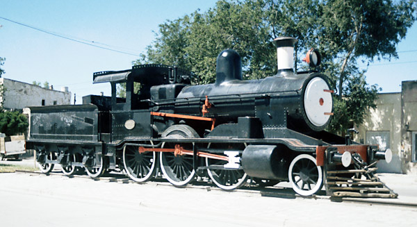
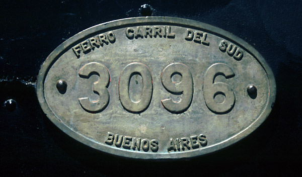
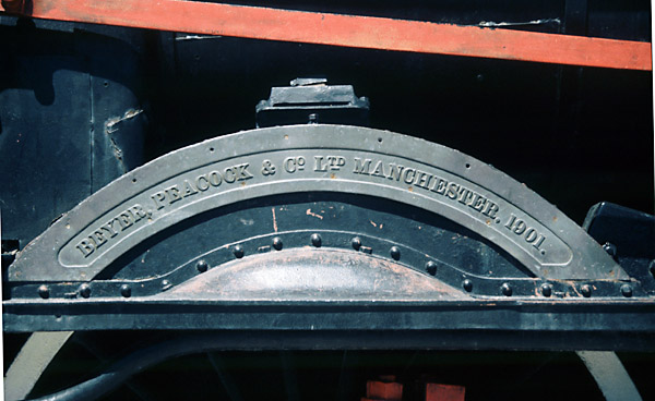
In the central reservation outside the station stands Beyer, Peacock 2-6-0 no. 3096. Local gossip suggests that this was the very same pilot engine shown on the opening day photo above. Given that the engine has stood there for forty years or more it is in remarkably good condition, though with the usual graffiti inside the cab.
The State Railways resolve to build a connection Whilst the two southern lines would have to remain isolated, it seemed silly to leave the San Antonio line unconnected from the national network. After a long interval therefore work restarted in the 1920s not merely to complete the western end of the line as far as San Carlos de Bariloche, but also to stretch back eastwards from San Antonio towards Viedma and the FC Sud which had reached Patagones on the other side of the Río Negro. The route from San Antonio to Viedma was relatively easy to construct. It had to start by going west and then branching off the Bariloche line in a big curve to the north. This took the line around the tidal bay on which San Antonio stands. From then on the line undulates across the dry plains with no noteworthy features. The decision was made in 1922 to construct this line with the initiation of the surveys necessary to establish the route. The brief was for as direct a line as possible, with gradients no more than 6 ‰ (1 in 167) and curves no sharper than 400 metres (20 chains). The possibility of the provision of a line to the deep water at San Antonio Este was to be taken account of. Three intermediate stations were proposed, thus giving runs between stations of no more than 50 kilometres (on the line from Puerto Deseado the original intention had been to provide a station every 20 kilometres). There was, of course, the need to get across the Río Negro to link up with the FC Sud at Carmen de Patagones, and the decision was made to use the same line as that authorised by Law 8448 of September 1911, made in connection with the concession granted then to Messrs Bloomfield & Co. The physical work was started in May 1922 from both ends of the line, with the emphasis on getting rails laid. Thus all the bridges were made initially as temporary structures, usually big sleeper cribs. [Memoria 1926, 1610rl1] By 1926 Viedma (the capital of Río Negro province) had been reached. This remained the terminus for several years whilst the big bridge across the river was constructed. The Río Negro is a couple of hundred metres wide even at the narrow point chosen for the bridge, and the currents can be up to 6 knots. On the north side the land rises steeply not far from the bank and the line from the north stands at about 100metres above the river level. On the south side the ground is lower and flatter. In addition the river was at that time used by sea-going sailing vessels and clearance would have to be left for their masts. The 1925 report by the FCE's new Administrator general, Dr. E. Pérez, discusses the pros and cons of various locations and bridge types whilst coming down firmly in favour of a lifting rather than swinging bridge on the site first proposed (1). The Memoria for 1930, shows that little work was done on the line during 1929. However one job was the provision of a turntable at Viedma. There was an 18.30 metre one at San Antonio which was suitable, other than it was too short for the Baldwins. Accordingly, it was lengthened to make it 20.30 metres on site to accommodate them. Also carried out was the deposition of rock around the bridge piers to avoid the river bed's being scoured away. [Memoria 1930 1610LP3] Viedma station pictured in December 2000.
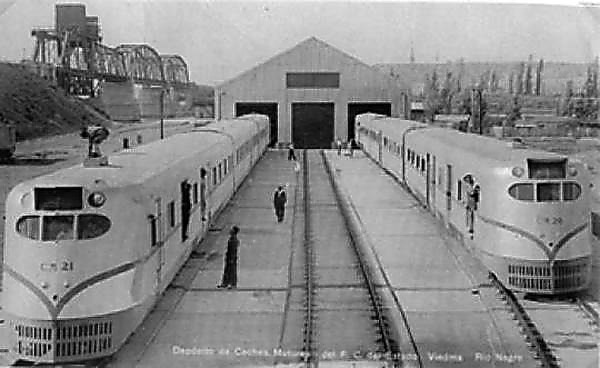
The line clearly had to climb from Viedma station to a sufficient height to give clearance for shipping. This meant a high level bridge from which northbound trains would then start a second sustained climb, through curving cuttings to reach the FC Sud. However, it required a massive embankment climbing east from Viedma station and curving round northwards to face the river. The obvious course of action would have been to construct the south bank embankment from material extracted from the north bank cuttings, but this would have required the bridge to be built first so it may not in fact have been the chosen strategy. To the east of this embankment on the river bank was built a locomotive depot. The presence of two pristine looking 'Trenes Bariloche' in what is clearly a new depot dates this photos of Viedma to 1937 or soon after. The bridge is clearly visible to the left.
The depot behind the trees has been demolished, but the wharf constructed to land goods and fuel still stands.
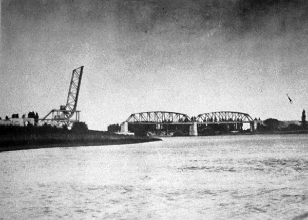
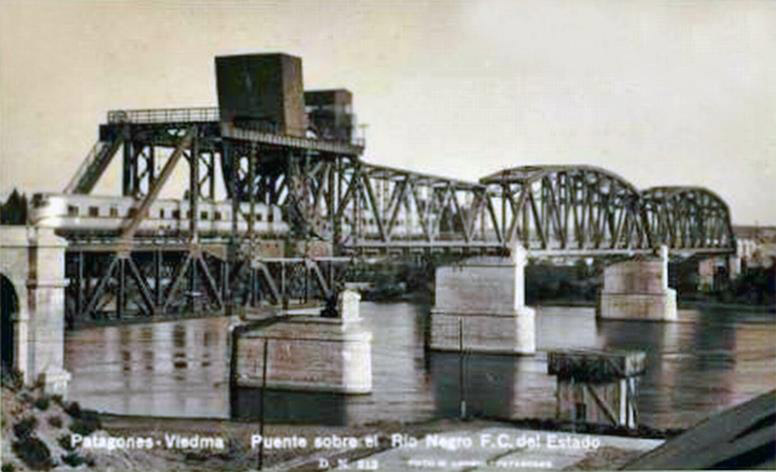
The bridge was constructed of three fabricated steel spans the southernmost of which was a lifting bascule. This brought the lifting mechanism to the south side next to the loco depot, and no doubt the power was provided from the site. The whole structure was completed and opened to traffic - road and rail - in 17 December 1931. The bridge under construction, with the nearer pier apparently complete, and the other well under way. The view would seem to be from the north bank.
The photo was taken from the south bank east of the bridge (downstream).
Another photo taken around the time of the bridge's completion looks northward from the top of the lifting span.
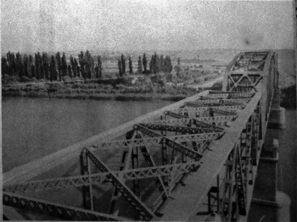
A train heads north off the bridge towards Patagones station a couple of miles away.
It seems unlikely that the lifting span was opened very often even in the early days, and it is clear that it has not been operated now for many years. Indeed even trains are now rare visitors. The FerroClub Patagónico at Viedma have published some views which are new to us. These two views show trains coming off the big bridge over the Río Negro on the Patagones side. The upper ones shows the engine driver preparing to exchange the staff which presumably interlocked with the bridge mechanism to prevent its opening during the passage of a train.
The second view is an earlier one of a Tren Bariloche at the same place with a crewman leaning out the door in preparation to exchange the train staff.
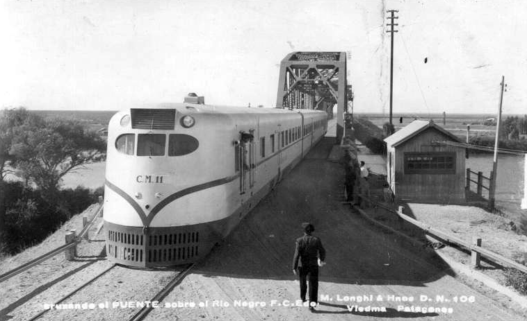
Another view of a Tren Bariloche, this time on the lifting span.
A view looking south through the spans. Whilst the road is used constantly by local traffic there is now another road bridge further west and the Ruta Nacional 3 has been diverted that way.
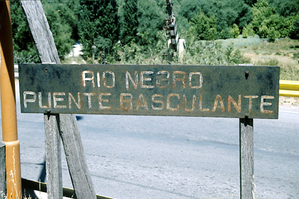
The cabins and barriers, which once controlled road traffic when a train was due, are still more or less complete. The bridge's nameboards are also still legible though they could do with a new coat of paint.
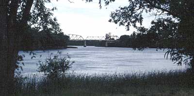
There is a website which shows a number of pictures of the bridge during its construction and in recent years. (2) Click here to visit it. A recent picture looking from the waterfront park in Viedma east towards the bridge.
The electronic version of the regional newspaper, Río Negro, announced on 9 September 2012 that from the following day the big bridge over the Río Negro would be closed to all road traffic for about 18 months (ie to about March 2014) to allow a total refurbishment of it by Vialidad Nacional [the national roads authority]. The work was to include sand blasting, followed by complete repainting, together with the provision of a path for pedestrians and cyclists and improvements to the road at each end. Accompanying the article was a recent view at the south end in weather that looks decidedly rainy. Source:— Río Negro online 03/09/12. [entered 22/2/15]
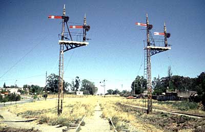
A t the end of June 2013, there was a meeting of various national and provincial authorities in connection with the nearing completion of the road-rail bridge over the Río Negro indicating that the work of refurbishment and repainting would be complete by the end of October that year. Source:— Found in Crónica Ferroviaria (entrado 29/6/13) North of the river crossing the line enters a long curving cutting on an S-bend. This brings it to join the line from Bahía Blanca just south of Carmen de Patagones station. As implied earlier, both lines come into the station from the south-east. Home signals at the junction. The line from the bridge comes from behind the photographer whilst the Bahía Blanca line curves in from the right. A close look at the starting signals in the distance shows that the Bahía Blanca route was clearly regarded as the mainline.
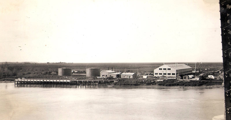
This view provided by Héctor Guerreiro was taken from the big bridge and shows the wharf originally used for importing coal. The muelle extends the length of the white band, the rest of the structure to the right is a curved access viaduct for the two railway sidings on the muelle. The big white building with roof lights is the depot for the Trenes Bariloche. There is clearly also quite considerable liquid fuel storage available on site. The picture was taken in November 1943.
Timetables The working timetable for 1946 has been studied, and also the public passenger timetable for late 1955 which is available on an appendix page. In 1946 there was a passenger train six days per week from Patagones to San Antonio Oeste, though not always at the same daily times, in each case going on to Bariloche. There was also a through mixed train on a Tuesday, a goods train five days a week to Bariloche or Ing. Jacobacci, and a pickup or wayside goods twice weekly over Sunday and Thursday nights. In 1955 the 'Tronador' train ran on Thursday and Saturday, departing Patagones at 1305, whilst train 37 departing early evening was loco hauled on Tuesdays but made up of a coche motor on Thursday and Sunday. The passenger trains took between four and seven hours for the journey to San Antonio, with the coche motor being quicker at 3 hours 15 mins., and the goods trains being allowed 8 hours 30 minutes. A study of these timetables is illuminating. Far from San Antonio Oeste being the hub of the line as was originally intended, it is clear that most trains ran through from Patagones to Bariloche or vice-versa. Whilst there would have been the linking shuttle services to and from Empalme Km. 191 to give access to San Antonio and its port, and the water train to and from Valcheta, it is clear that on most days San Antonio Oeste station would have seen no more than one or two movements in 24 hours. Whilst the works would have undertaken work for all three Patagonian broad gauge lines, and also for the 75cm gauge, it too would have been much more quiet and sleepy than had been expected when it was built. A visit in 2000 gave the impression of a railway centre much reduced from its heyday, but the truth is probably that there never had been such a period and that mauh of the equipment and facilities had possibly never been used. References: 16-11-16 |
||||||||||||||||


Chapter 4
The FCE broad gauge network
Main pages
Bariloche line rolling stock •
Com. Rivadavia line extra photos •
Pto. Deseado line extra photos •
Pto. Deseado line extra photos 2 •
Appendices
2 Chronology of Patagonian railway proposals •
3 Bariloche line route itinerary •
4 Com. Rivadavia route itinerary •
5 Pto. Deseado route itinerary •
7 Com. Rivadavia line loco list •
8 Pto. Deseado line loco list •
15 FCP working timetable instructions 1960 •
16 Report on construction 1912 A •
17 Report on construction 1912 B •
21 President Alcorta address •
23 Purchase of wagons decree •
25 Early Patagonian proposals •
26 Progress to Bariloche 1926 •
28 Restructuring report 1953 •