 |
 |
 |
|||||||||||||||
 |
|||||||||||||||||
|
|||||||||||||||||
Chapter 6
The Chiloe Island 60cm gauge railway
Main pages
The Chillan to Las Termas line •
Appendices
3 Analysis of Chilean 60cm gauge locos •
5 Documents from prior to construction •
6 Documents during construction •
7 Documents from later years •
Map of Linares to Colbún route and itinerary of locations
This is a higher resolution version of the map on the Linares to Colbún route page, and showing the (very unexciting) gradient profile. These maps were originally published in ???
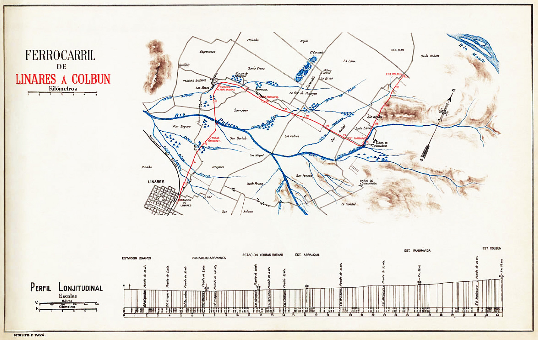
Route itinerary – Linares to Colbún |
||
Km. |
Station or feature |
Facilities, notes |
0.496 |
Linares station |
|
1.? |
5m bridge over |
|
3.? |
5m bridge over |
|
5.? |
10m bridge over |
|
7.? |
5m bridge over |
|
7.238 |
Paradero Arrayanes |
|
8.000? |
100m bridge over Río Putarán |
|
11.? |
10m bridge over Estero Abranquil |
|
11.820 |
Yerbas Buenas station |
|
12.? |
5m bridge over |
|
14.? |
30m bridge over Estero Abranquil |
|
16.340 |
Abranquil station |
|
19.? |
10m bridge over Estero de la Barra? |
|
19.? |
Level crossing with coal bunkers immediately to east |
|
19.408 |
San Juan station mentioned in provisional timetable |
|
23.? |
20m bridge over |
|
24.5 |
Rari station mentioned in provisional timetable |
|
25.6 |
Km 25.6 station mentioned in provisional timetable |
|
26.122 or 27.5? |
Panimávida station |
|
31.? |
?m bridge over Estero ? |
|
33.300 |
Colbún station |
|
A report during construction period talks of bridges Abranquil 1 & 2, and Machicura 1. Also bridge over Estero Caballo Blanco no. 1 consisting of 3 10m spans. |
||
Surviving relics
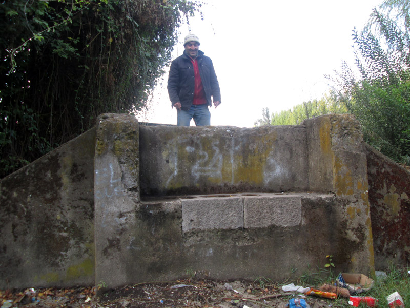
The narrow gauge station and depot at Linares, on the east side of the broad gauge, has long since given way to new land-uses and to a road underpass beneath the mainline. Further north, however, the trackbed can generally be clearly distinguished using Google Earth, though much has become very overgrown and would be difficult to walk unless currently used as a farm track. Concrete abutments of the bridge over the Río Putarán are presumably still in place, as are others over minor streams or irrigation ditches. The site of Yerbas Buenas station has been re-used for housing.
A concrete bridge abutment shows the site of the railway alignment just south of Yerbas Buenas station.
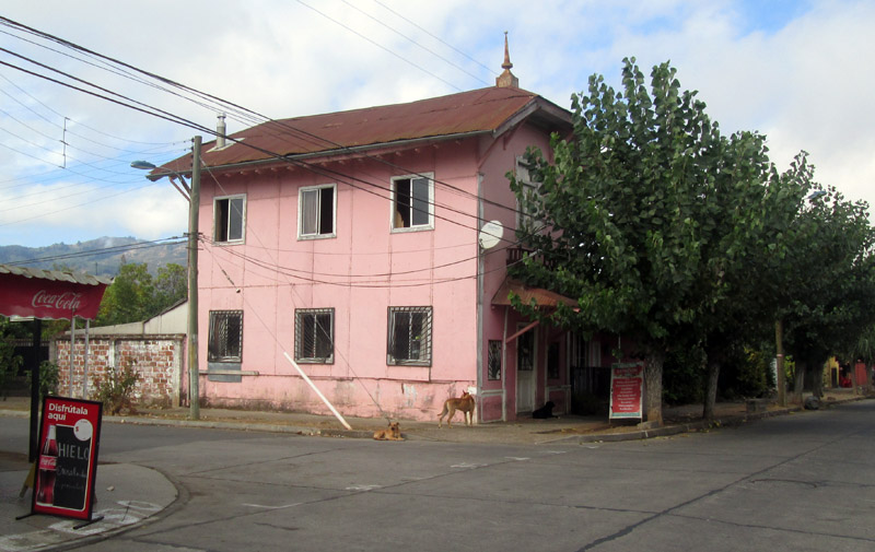
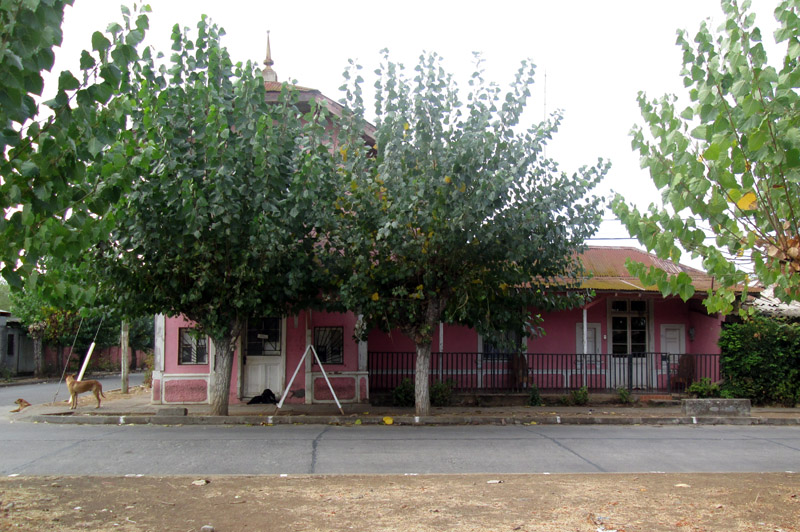
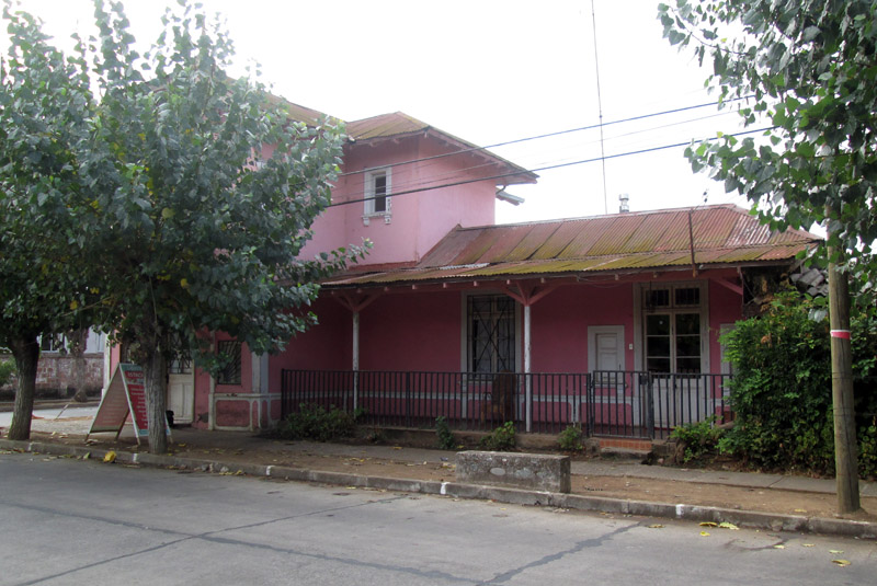
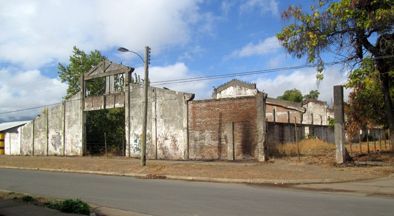
Approaching Panimávida, at Km 24 there are supposedly concrete coal bunkers still surviving just after a level crossing site, but these are on private land and permission to examine them was not forthcoming. Panimávida station's two storey wooden building does, however, still exist, in a fetching shade of pink and in use as a ‘librería’ or stationery store. Just to the east of it are the derelict concrete walls and roof beams of the water-bottling plant, though new houses have taken over part of the location of the siding which led to its north end.
Panimávida station building is shown in the following three photos, taken in April 2016. The first view is from the north-west, whilst others show the western frontage that would have faced the tracks.
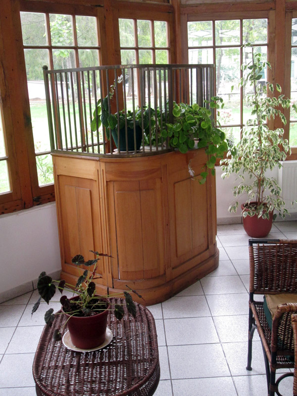
In the spa hotel 'Termas de Panimávida' there is preserved a ticket counter and grill, supposedly rescued from the station.
The water bottling plant behind the station at Panimávida is now derelict.
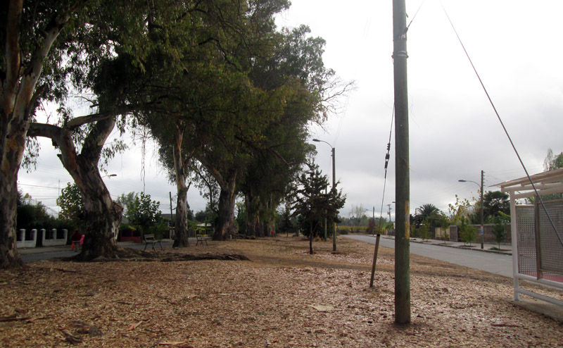
Looking north from Panimávida station: the tracks would have been on the line of the surfaced road to the right, though in the distance that road terminates in a sharp bend to join the main road north seen on the left.
The final stretch of the route... the track northwards ran east of the parallel main road. There is now no sign of the location of Colbún station, which was just north of the plaza and behind the present-day school.
4-5-17