 |
 |
 |
|||||||||||||||
 |
|||||||||||||||||
|
|||||||||||||||||
Chapter 6
The Chiloe Island 60cm gauge railway
Main pages
The Chillan to Las Termas line •
Appendices
3 Analysis of Chilean 60cm gauge locos •
5 Documents from prior to construction •
6 Documents during construction •
7 Documents from later years •
Map of Chillán to Recinto and Niblinto routes, alternative proposals for facilities in Chillán, and itinerary of locations
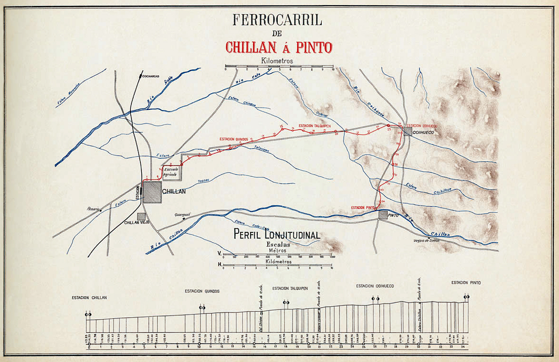
The map below is a full-sized version of that shown on the main Chillá - Las Termas page. It shows the first section approved for construction, as far as Pinto.
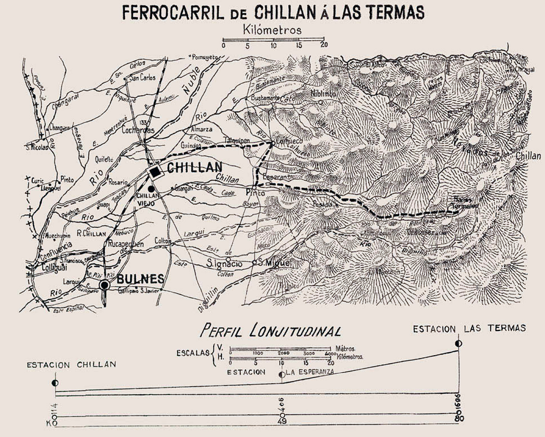
The next map, to a smaller scale, purports to show the line continuing east towards Las Termas, but note that the route is not shown accurately.
Route itinerary – Chillán to Coihueco, Pinto and Recinto, and the branch to Niblinto |
||
Km. |
Station or feature |
Facilities, notes |
0 |
Chillán station |
Altitude 114m. Bodega para carga EFE resisting DOP taking land, station already too narrow. |
Paradero Cruz de Rifo |
A halt at the junction of Avenida Ecuador and the streets Dieciocho and Avenida Francia. |
|
Estación or paradero Santa Elvira |
At the entrance to the army barracks, in the old district of Santa Elvira |
|
Estación General Lagos |
Altitude 167m. Edificio, oficinas, casa habitacion |
|
15.??? |
Bridge over Estero ???, ?m span. |
|
Estación Talquipén |
Altitude 206m. Edificio de dos pisos, oficinas i casa habitacion |
|
20.??? |
Bridge over Estero ???, ?m span. |
|
Estación Coihueco |
Altitude 253m. Edificio, oficinas, casa habitacion |
|
30.??? |
Bridge over Estero ???, ?m span. |
|
About 5km south of Coihueco |
Paradero Roblería |
Altitude 253m. |
35.027 |
Estacion Pinto |
Altitude 275m. Edificio de dos pisos, oficinas, casa habitacion |
?? |
Estación Tanilvoro |
Altitude 363m. |
48.529 |
Oblique culvert of concrete, 1.5m span. |
|
49.??? |
Estación La Esperanza |
Altitude 614m. Water column |
54.918 |
Concrete bridge of 14.4m span. |
|
56.032 |
44m steel bridge, three spans of 7, 10 and 7m. |
|
56.300 |
44m steel bridge, three spans of 7, 10 and 7m. |
|
?? |
Paradero Barrón |
|
80.??? |
Estación El Recinto |
Altitude 798m. |
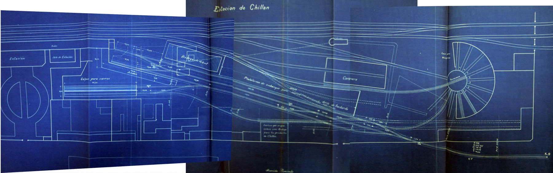
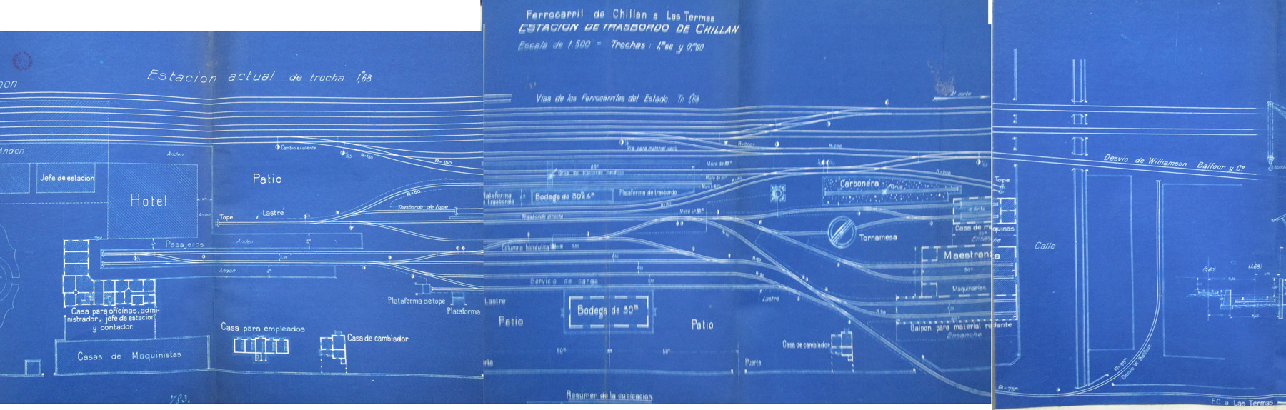
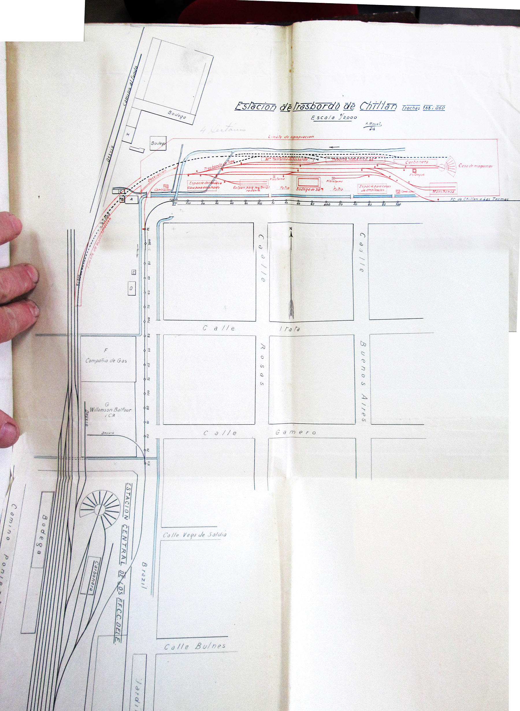
The blue-print plans below show alternative proposed narrow gauge layouts at Chillán. The first two have everything laid out parallel to the broad gauge mainline,
with north being to the right and south to the left. The third plan on the other hand has the main narrow gauge facilities well north of the broad gauge station and
around a 90 degree curve. In this case north is to the top of the plan.
At present it is not known which of these layouts - if any - was adopted for construction and operation.
Surviving relics
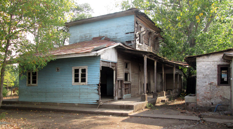
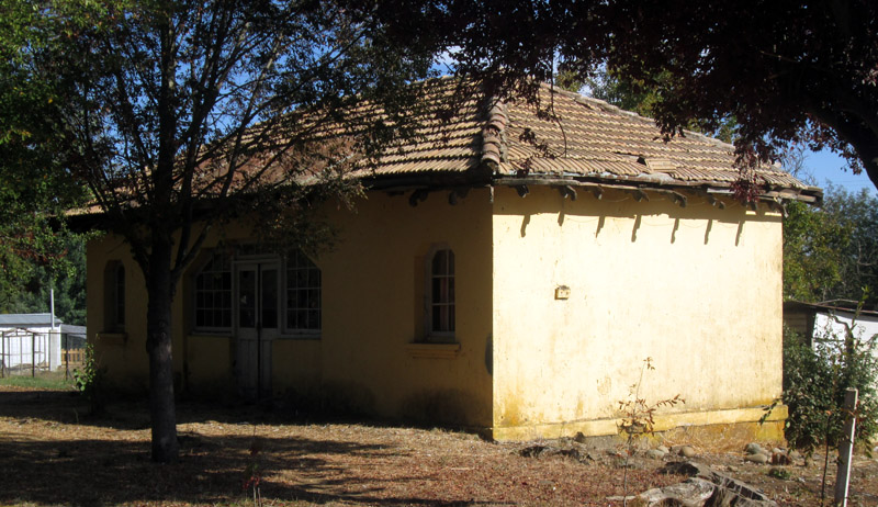
The station building at Talquipén was used for many years as the village school, but is now derelict. It is littered thoughout in paper, but unfortunately this all dates from its years in education rather than being from the railway.
The front facade is of a standard layout, like that at Lumaco, with from left three doors, a window, a door and finally one more window. This would have been the platform face, with two or more tracks to the left of the picture.
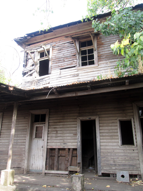
The rear is rather more battered.
In front of the main building, and to the east, is the goods platform on which there would presumably have been a goods shed or 'bodega'.
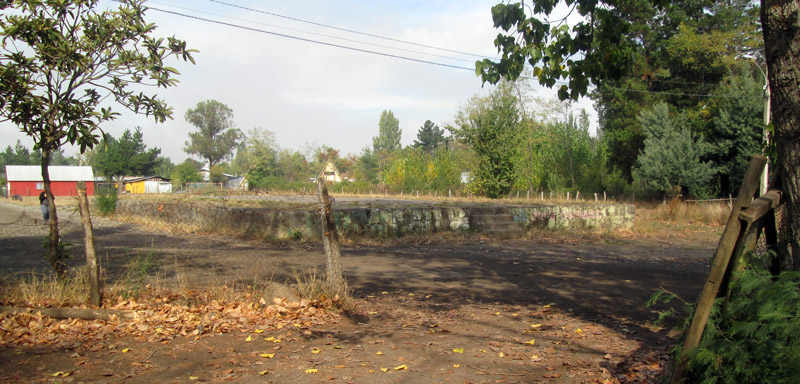
Whilst the trackbed through Coihueco station has been tarmaced and is now a residential street, this shed remains. It seems likely that this was the 'casa de camineros' or PW gang hut of the erstwhile station.
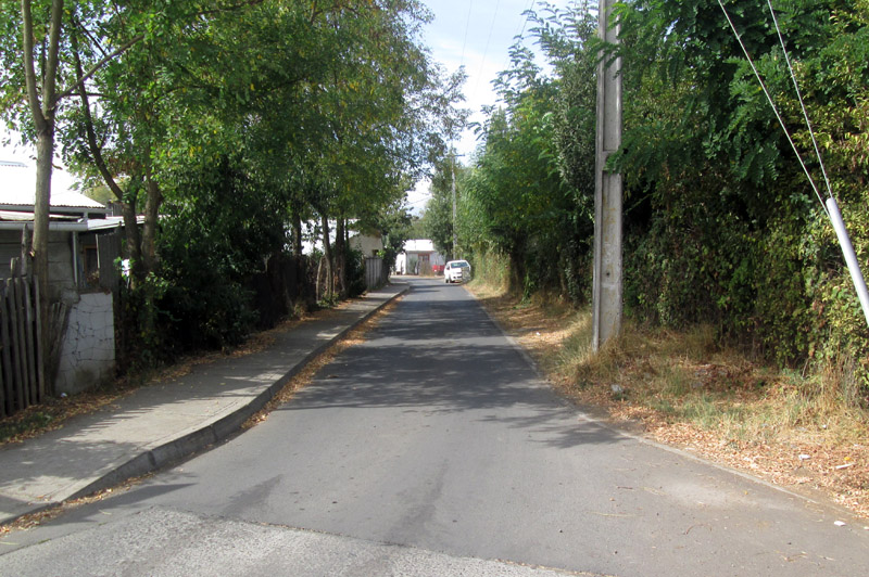
Looking east along the trackbed. At the end, by the white car, the route to Pinto & Recinto, and that to Niblinto, would have diverged right and left.
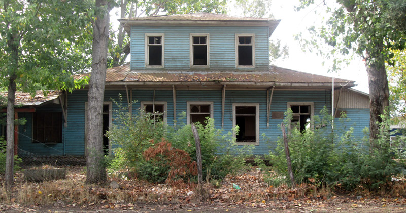
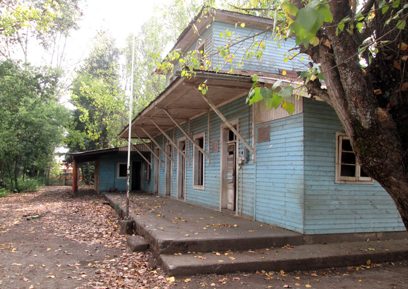
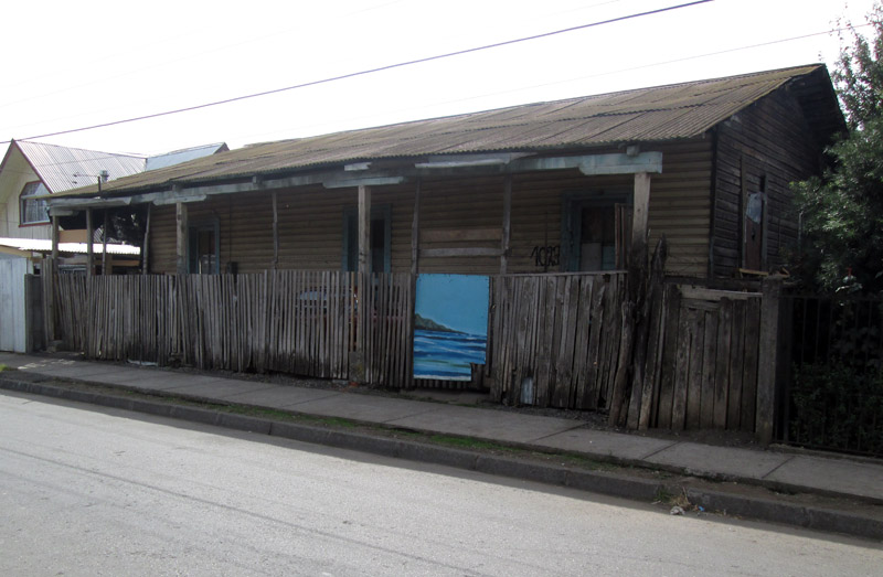
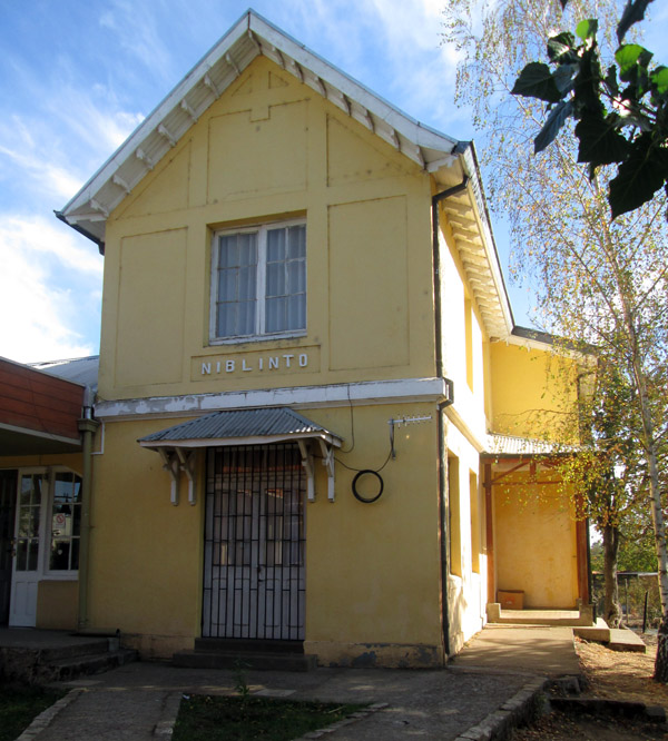
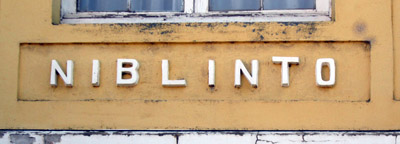
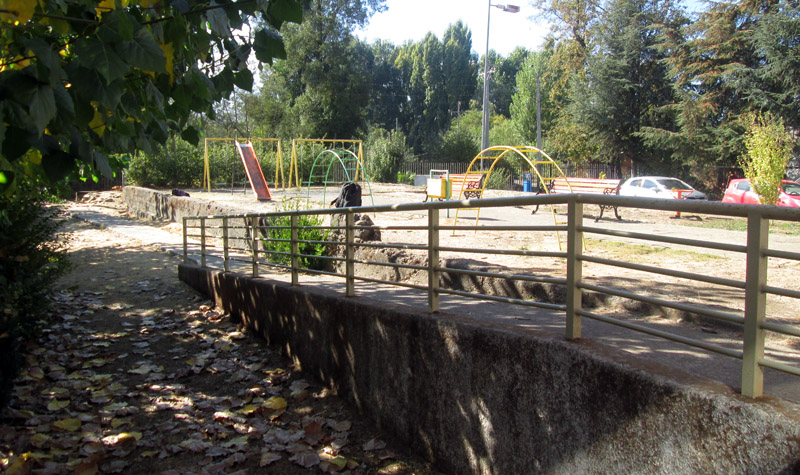
The original wooden Niblinto station building was destroyed by fire at some point during the life of the railway, and was rebuilt in brick. It too became a school, and remains as such to this day. This is the south face of the building, which would have faced the tracks.
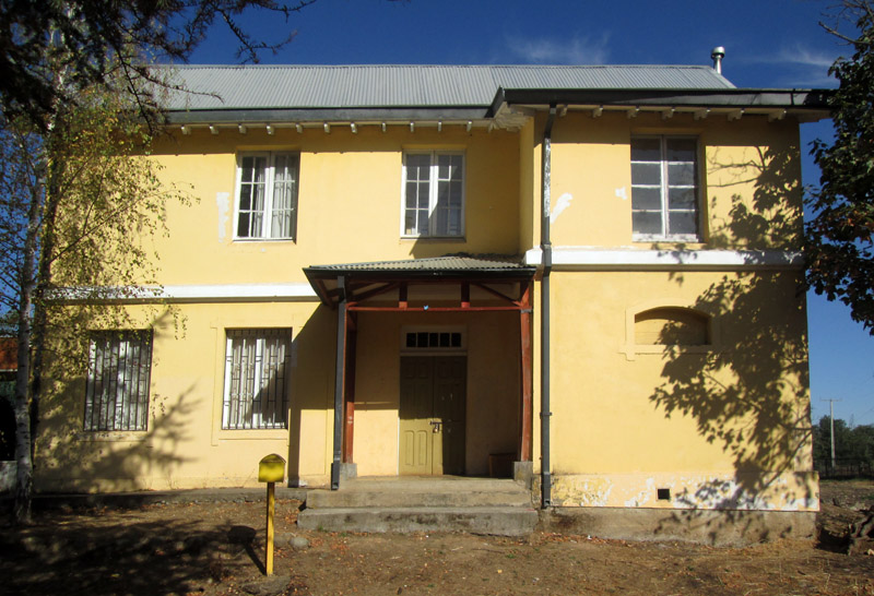
…and the east face.
It seems likely that this hut just to the west of the main structure, was a platform shelter for waiting passengers.
In front of the main building again there is the goods platform, though no trace survives of a goods shed. The ramp is probably an addition by the school but the older concrete behind shows the original dimensions of the structure. It is now used as a playground.
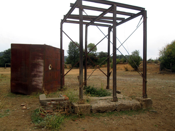
The only surviving structure at El Recinto is the water tower, though even that has come apart with the tank now lying adjacent to the rail-built framework.
25-2-17