 |
 |
 |
|||||||||||||||||||
 |
|||||||||||||||||||||
|
|||||||||||||||||||||
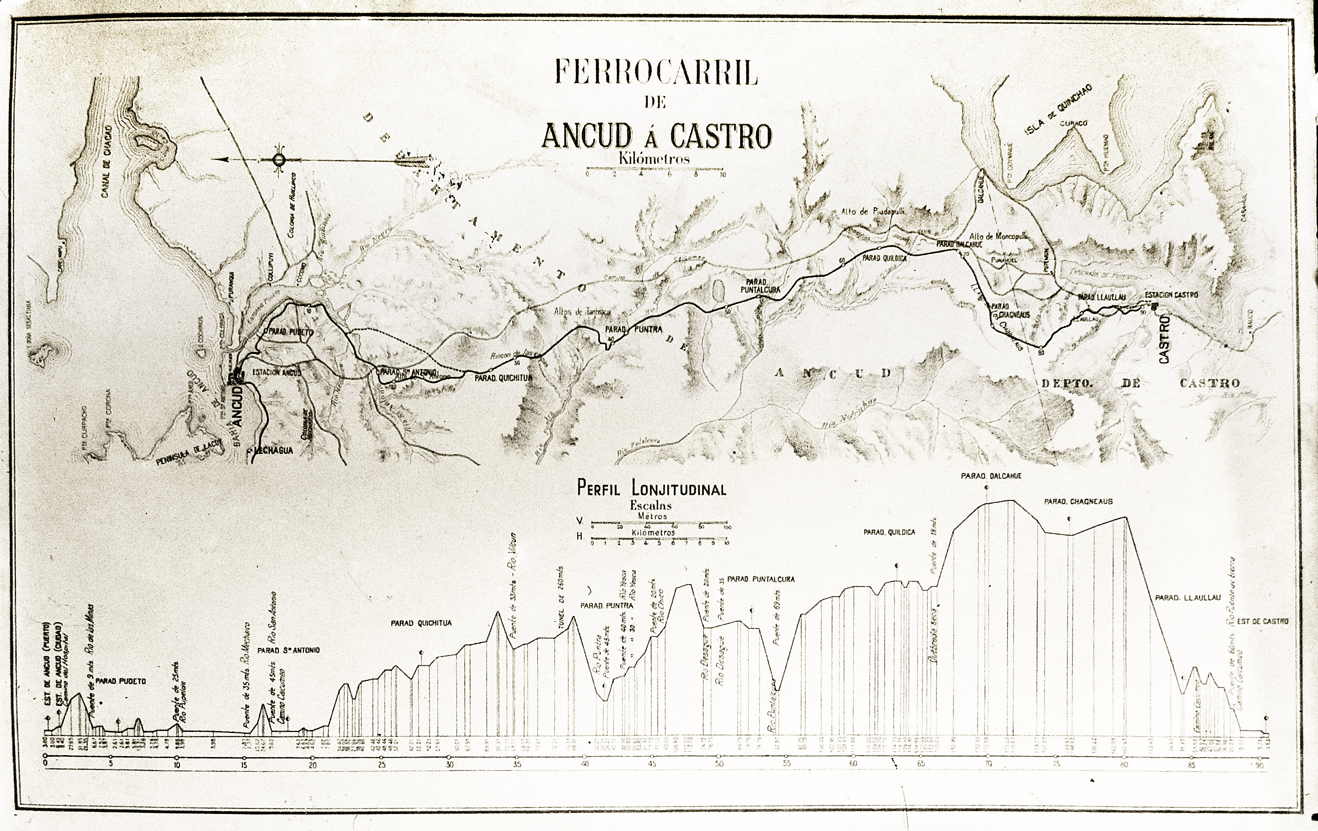
Appendix 2 Map of the proposed railway route, and gradient profile. Full size version. This map and profile date from when the proposed route was being refined, in about 1909. They therefore need to be read with caution, for substantial stretches are known to have changed by the time that construction began. Similarly, the names and locations of the stations sctually constructed are different in some respects from those shown here, and the names in particular were altered after the opening of the line. |
|||||||||||||||||||||
 |
|||||||||||||||||||||
Reference: 5-6-11 |
|||||||||||||||||||||
Chapter 6
The Chiloe Island 60cm gauge railway