Appendix 1
Topographic maps of Comodoro Rivadavia showing 60cm gauge YPF railway routes
The two maps below were published in the 1950s but a note made it clear that the bulk of the geographic detail on them dated from
around 1929. The grid squares are two kilometres apart. It will be noted that there are a large number of pipelines, power cables and
other features criss-crossing the maps.
NB These are very large files which will take a while to download.
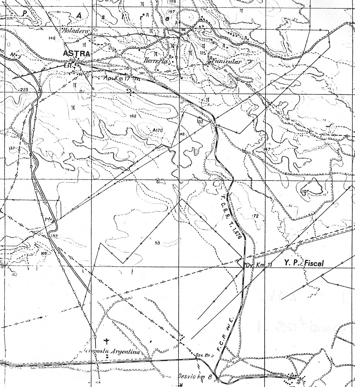
The first extract shows the broad gauge Astra branch from its junction with the main line north to its terminus. Narrow gauge routes
were shown on these maps by a black line with paired ticks on one side. The only such railway shown here stretches WSW from
Astra station in a straight line for almost one kilometre. There were no such narrow gauge routes visible in the Caleta Cordova area
of the original map.
The second map extract shows a much more crowded and interesting area. At the top is the junction for the Astra and Comferpet
branches as mentioned above. At the foot is Comodoro Rivadavia town centre, and the busy Km 3 and Km 5 areas are thus covered.
The broad gauge main line runs north up the coast before turning inland past the aerodrome. There are also a number of YPF 60cm
gauge lines visible. Upwards of 20km of these are shown, from the YPF muelle northwards to Km 5 (Roberto M. Ortiz), and with
extensions westwards towards Barrio Saavedra and towards Ferrocarrilera. This latter location was named after the Cia. Ferrocarrilera
y Petroleo which exploited that district. This company was largely owned by the various British and French Argentine railway companies.
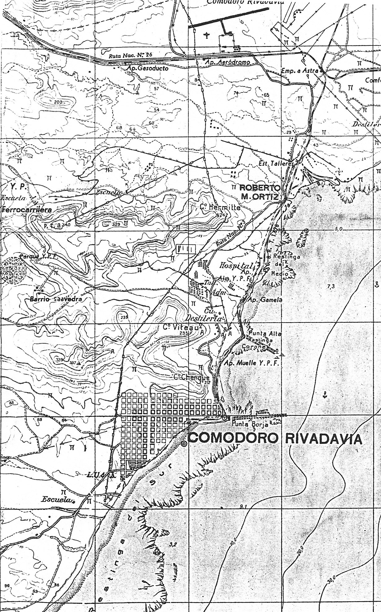
It will be noted that there is no sign of the 75cm gauge railway to Rada Tilly on this map. I suspect that the base mapping dates from earlier
than 1929 and that perhaps only the most important features for each map sheet were added later. Since this sheet terminated just south of
the town centre perhaps a route southwards was not considered essential.
25-5-11
|