Patagonia, 'Araucania', Tierra del Fuego et al
 Location Location
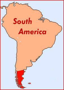
This website covers an area stretching for 1000 miles down to the tip of South America at Cape Horn. As well as the continental mainland it includes the multitude of islands which make up Tierra del Fuego, the more distant Atlantic islands known as The Falklands or Malvinas, and their dependencies. In addition one chapter deals with Chiloé Island, the most northerly in the long chain down the Chilean coast.
Relief
Topographically the area can be divided into three lengthways. First, the rugged and islanded west, with tremendous rainfall and the resulting dense natural forests, where they have not been cut. Second, the snow-covered southern end of the Andes mountains with glaciers running down, mostly to Fjords on the west side. Finally, on the east, a great and desert-like plain dipping down to the Atlantic
Original inhabitants
Until the arrival of Europeans the area was inhabited by Yahgans, Alacalufs, the Tehuelche, Onas and other tribes living an extremely tough life amongst the guanacos, penguins, steamer ducks and other strange fauna. Regretably the indians were almost wiped out by callousness, cruelty and their lack of immunity to diseases like measles brought by the later settlers.
Early exploration
Hernando de Magellanes arrived in 1519, searching for a way through to the East Indies, and finding it in the straits now named after him. He was followed by Francis Drake who discovered that Tierra del Fuego was a myriad of islands rather than an extension of the Antarctic continent. Early Spanish attempts to settle the straits area came to nothing, but there was periodic interest from each of the European powers, for the route around the south was the only way to the Pacific. Slowly the area was explored and surveyed. A glance at a map shows names indiscriminately of Spanish, British, Dutch and German origin down around the straits. At this time there was much less attention being paid to the inhospitable semi-desert further north, though on the west coast Chiloé Island had been settled.
Whilst Spanish attempts to settle the area ceased after the wars of independence, one notable visit in the early 19th century was of Captain FitzRoy in the Beagle with his passenger Charles Darwin.
National Boundaries
By the 1840s the newly independent countries of Argentina and Chile made their territorial ambitions clear with the result that the boundary between the two countries lies down the Andes mountains and then cuts across to the Atlantic coast at Cabo Virgenes before following a meridian down through Isla Grande, the largest island of Tierra del Fuego. A rather unbelievable attempt to declare an independent kingdom of Araucania down in the extreme south had quickly come to grief. In the same period Great Britain built up a presence in the Falkland Islands (Islas Malvinas) out in the Atlantic, particularly as a supply station and bunkering port for the many ships rounding Cape Horn.
Originally the Argentine plains were defined as separate territories, but more recently they have become fully-fledged provinces, as 'Río Negro', 'Chubut', 'Santa Cruz' and 'Tierra del Fuego y las Islas Atlanticas'. On the Chilean side the province of Magellanes covers all of our area except Chiloé.
Economic settlers from diverse lands
As the nineteenth century progressed there was steady development of the economic possibliities of Patagonia and the islands. Sheep farming, forestry, gold mining and whaling were amongst the activities which brought settlers. And these were not merely from further north in the Americas. It is a fallacy to believe, as many Europeans do, that South Americans are all of Iberian descent. There were Italians; Welshmen seeking a new start without linguistic or religious interference; Scots ranchers in Santa Cruz; and perhaps most unlikely of all, large numbers of Croatians seeking gold down in Tierra del Fuego.
In amongst this mixture there were more transient visitors, drawn by the 'wild west' or perhaps 'wild south' atmosphere - Butch Cassidy and Co., and groups of Chileños, the labourers from Chiloé Island who had gained a colourful reputation whilst doing many of the region's hardest jobs.
After the opening of the Panama Canal in 1912, the amount of shipping rounding the Horn declined dramatically. This had a knock-on effect on the whole area. For the following sixty years or so much of the region went into decline. Whilst there were isolated developments, of coal, and oil, it took government subsidies in the 1980s to bring something of a boom to the far south.
A surprising number of railways
This website catalogues at least thirty individual railway lines, and there were many more short-lived mining, estancia and forestry lines yet to be recorded. This is not as surprising as it first appears. If late-nineteenth-century economic man wanted to get resources out to the coast, or settlers and supplies inland in an area without roads, then he built a railway. The majority were of narrow gauge, with the exception of three lines in from the east coast. Most of them have now gone, as road transport has taken over.
|